Showing posts with label Road End. Show all posts

Wednesday, June 29, 2011

City ‘reassesses’ road-end blockage policy


By Bryan Tagas

As a result of a unanimous action of the Seattle City Council earlier this month, waterfront property owners who block access to public right of ways will now have to pay more—significantly more—for the privilege.  The City’s new stance has immediate implications for the two Madison Park property owners whose landscaping completely blocks access to the public waterfront at the E. Mercer Street road end.  The new fee schedule is retroactive to January 1, though it will be three more years before full implementation is phased in.

As we reported on this blog and in a front-page story in the Madison Park Times earlier this year, our neighborhood’s sixth public road end has been unusable by the public for many decades. The 120-feet-wide property is located south of the Seattle Tennis Club in an area of 39th Avenue E. known to locals as “Devil’s Dip.”   Though this prime lakeside real estate belongs to the City and is under the jurisdiction of its Department of Transportation, you’d never know it from looking. Conifers and hedges block access to the shoreline and almost totally obscure the view of the Lake.  This situation may change, however, if the abutting property owners decide that the cost of blocking public access is now too steep.  It appears that they will ultimately have to pay at least two times as much for annual permit fees as they have been paying.


But before we get into the details of the City’s new policy and its potential for opening up the E. Mercer Street road end to public use, let’s revisit how this particular piece of Madison Park waterfront ended up as a private reserve.  Since our original story was posted, several longtime residents have come forward with identical—though at this late date, unverifiable—stories about how the street was effectively “vacated” by the abutting property owners; in particular, the owner of the property to the north of the road end, Jacquetta Blanchett Freeman. According to local lore, Ms. Freeman, in order to discourage use by the madding crowd, installed a water-sprinkler system on the public right of way. Whenever she saw someone on the road end she would come out to verify if it was one of her friends or their children; and if not, the sprinklers would suddenly spring to life.  Over the years, Ms. Freeman successfully aborted the picnics, sunbathing activities, and assignations of many unsuspecting visitors to this public site. Eventually, strategic landscaping did the rest—and the public nature of the northern side of the road end became lost to history.

Or so the story goes.  According to one of our sources, there was also a concrete stairway from 39th Avenue E. that onetime provided access to the public waterfront.  That stairway was apparently removed at or before the time Ms. Freeman (or perhaps the previous property owner) convinced the City to allow the construction of a double-wide garage in the middle that public space. That garage is still there.


The property owner just to the south of the road end, meanwhile, planted a hedge of Portuguese Laurel across the southern third of the public space and then created a lovely side yard for himself by extending the hedge straight to the waterline, paralleling his own property.


As we reported, the current owners of these properties did not originate the encroachments but are simply the beneficiaries of a City policy that allows each of them to keep the benefits of excluding the public from the site by paying annual fees of $35,100 and $21,800, respectively.  What our investigation uncovered was the fact that for the entire ten-year period during which the fees have been charged, the City never updated the assessment of area property values upon which its fees were based.  By our estimate, the average assessment by the King County Assessor in 2010 was $467 per square foot for the close-by properties along 39th Avenue E.  In determining the encroachment fees, the City has been using $90 per square foot, the assessment it had originally arrived at in 2000.

This failure to keep pace with market values is what the City Council is attempting to correct with its newly passed ordinance. The original ordinance failed to allow for the use of King County Assessor data when determining fees, and the City had been remiss in never sending its own assessor to the property to re-evaluate the site based on current market conditions.

The new ordinance corrects this oversight by requiring that the land value of the encroached-upon space be based on “the abutting parcel’s current land value per square foot as determined by the King County Assessor.”   This is a big change.  The 2011 assessed value for the abutting property to the south of the road end is $512.71 per square foot.  This would value the 4,800 sq. ft. of the enclosed public property on that side of the road end at $2,461,017.  That’s 5.7 times the value the City assessor had placed on the property and equates to an annual fee increase from $21,600 to about $123,000, all other factors remaining equal.

The abutting property to the north, meanwhile, is assessed at $177.61 per sq. ft., 1.97 times the value the City assessor had previously placed on the property.  This values the enclosed public property there at $1,385,358, which could mean an annual fee increase from $35,100 to about $69,000.  However, because the area encroached upon extends beyond the center line of the public space, part of the 7,800 sq. ft. that the northern property owner has enclosed may be subject to the higher rate paid by the southern property owner.  The ordinance appears to require this: “If the use area extends beyond the centerline of the right-of-way or abuts multiple parcels, the permit fee shall be calculated for each portion of the use area according to the current value of the abutting parcels.”

In any event, the new fees, though retroactive, will not be assessed in full this year.  According to Brian de Place, the City’s Manager for Right-of-Way Management/Street Use, the intention of the ordinance is to “soften the effect of the increase.” So the new fees will be phased in over the next four years, 25% of the total increase to be tacked on each year through 2014.

It has taken the Council about six months to go from drafting to passing the final ordinance, but the impact of this action could have the consequence—unintended or otherwise—of ultimately making the private use of this public space just too expensive for one or more of the abutting property owners to want to pay for.

Time will tell.

Sunday, January 2, 2011

Madison Park road end closed to the public

East Mercer Street: No Trespassing

By Bryan Tagas

For several decades the owners of two waterfront properties in Madison Park have taken for their private use the public road end which sits between their two properties. By doing so, they have excluded the public from what is publicly owned waterfront. This encroachment on the public right-of-way, which may have begun in the 1950s or before, was initially accomplished through the planting of hedges and other landscaping across the road end, thereby blocking physical access to the site and effectively eliminating the public’s view of Lake Washington from the roadway.

Although the City became aware of these illegal encroachments late in the last century, it has not required either that the obstructions be removed or that the waterfront be returned to public use. Ironically, the unsanctioned action of the former owners of these two properties in blocking off the road end provides the current owners with the ongoing right to keep out the public. Because this road-end encroachment has been “grandfathered” under current City rules, all that the abutting property owners have to do now is pay an annual fee for their continued private use of this public space. And that annual fee is not based on the current assessed value of the surrounding properties.

The public property in question is the E. Mercer Street road end, which is located off of 39th Avenue E. in the area several houses to the north of the E. Harrison Street public road end, better known as Hidden Beach. This section of 39thAvenue, just south of the Seattle Tennis Club, is known to locals as the bottom of “Devil’s Dip.” Although Mercer Street actually peters out well to the west of 39th, its stub street end on Lake Washington represents more than a quarter acre of prime Madison Park waterfront. At 120-feet wide, it is twice the width of the Lake Washington lot which abuts the road end on the south side.

Private encroachment on public property usually generates a significant level of public controversy and media attention. Just down the road and around the corner from the E. Mercer Street road end, for example, lies Viretta Park. Many will recall the public outcry in the 1990s that resulted from the supposed encroachment of a neighboring homeowner, Starbucks CEO Howard Schultz, into the Park’s public space with his landscaping, driveway, and wall. That brouhaha ultimately involved the City Council and the Courts, and Schultz ultimately exited the property. Currently, there is well publicized dustup underway in Laurelhurst over a hedge which only partially obstructs a waterfront road end there. That encroachment benefits a property once owned by Bill Gates, which is currently owned by his sister, Libby, and her husband. Several Laurelhurst residents are up in arms that even a minor private encroachment on that public space has been allowed to continue.

The conversion of the E. Mercer St. road end from public space to private use has never received the kind of media focus that has been generated by these other encroachments. This may simply be due to the fact that very few Madison Parkers are aware that the property in question even belongs to the public. One longtime resident, who lives just down the street from the road end, tells us he cannot remember the public ever having access to the site in the more than 50 years he’s lived there. When a group of community activists from Madrona attempted to get the City to return it to public use several years ago, the E. Mercer St. road end did achieve a bit of notoriety; but there was virtually no media coverage of the group’s efforts. In any event, the City rejected the group’s public-use challenge.

We made a Public Disclosure request to the Seattle Department of Transportation (SDOT) to learn the process by which the public has been legally excluded from this public waterfront site. We also questioned Brian de Place, SDOT’s current Manager for Right-of-Way Management/Street Use, about the situation. What we learned from our investigation is that while the City’s official policy is that “the highest and best use of these street ends is for public use,” there are exceptions. The E. Mercer St. road end is probably as extreme of an exception as is possible, since it involves the complete abandonment of public use.

Here’s a little history of the City’s attempt over the past few years to deal with private encroachments on waterfront road ends. There are 149 such road ends within the City limits, six of which are located in Madison Park. In 1996, the Seattle City Council passed a resolution stating that it is City policy that “Shoreline street ends…shall be preserved as public rights-of-way.” The resolution, however, was strangely silent on the issue of whether existing private encroachments on these road ends must be removed, and no procedure was established for determining when private usage of a public road end could be permitted.

This created an ambiguous situation, which the Council sought to clarify in a 1999 ordinance, which reaffirmed that the City’s goal was to “keep adjacent property owners from encroaching on the public’s shoreline street ends,” but then went on to outline the procedure by which existing encroachments would be permitted through the payment of an annual fee. The amount of the fee was to be based on the size of the encroachment in square feet, the percentage likelihood of the public wanting to use the site (the demand/probability factor), the extent to which any barrier on the site impeded public access (including visual access), and the estimated value of the land per square foot. An annual rate of return (the “land capitalization rate”) was also to be factored in.

The idea was to use the fees that are collected to fund the City’s shoreline street-end management program, including paying for improvements, the inspection of road ends, and the notification to property owners of any encroachments. The SDOT was directed to establish a policy for enforcing the new ordinance, which it did in 2000.

Now, to return to the E. Mercer St. road end. In July of 2000, the City notified the encroaching property owners to the north and south of the road end that they could either apply for a Shoreline Street End Permit or remove the barriers that existed to the public right of way. The letter from SDOT’s Street Use Division included this statement of the City’s philosophy: “Although the ultimate goal is to remove all private uses of these street ends, the permit process acknowledges some private uses will continue. This permit process provides a means to review and approve private uses, as appropriate, until the property can be developed for public use.” Both property owners chose to keep their barriers in place, and from that point forward they have been paying annually for the continued right to block public access to the waterfront at E. Mercer.

Initially, the annual private-use fee amounts were $28,080 and $21,600 respectively, the property owner to the north having encroached on 7,800 sq. ft. of public shoreline and the southern owner having encroached on 4,800 sq. ft. It appears that these fees were not adjusted in any way for seven years, but in 2007 the amounts were set at $35,100 and $21,600 respectively; and those are the annual fees the property owners are paying today. The increase in the fee for the northern property owner was based on the City’s evaluation that the barrier to public access had increased from 80% in 2000 to 100% by 2007.

It is not clear, however, that the City has correctly determined the permit-fee amounts for the E. Mercer Street encroachments. According to the City’s stated guidelines for calculating the permit fees, “values are generally based on averages of assessed values for waterfront properties within like areas.” But SDOT in 2000 assigned a value of only $90 per sq. ft. to the area of encroachment. This assumed land value was never updated when any of the ten subsequent permit renewals occurred, and it is significantly lower than the property values set by the King County Assessor for the neighboring properties. Indeed, the 2010 assessments for the 14 waterfront properties in Madison Park along 39th Avenue E. average $467 per sq. ft.

The 12,600 sq. ft. of public property at the E. Mercer Street road end, based on King County’s assessment of the “like properties” in the neighborhood, would be valued at almost $6 million. However, based on its permit calculations, SDOT’s estimate of the value is only $1.1 million. Quite clearly, if SDOT used a factor based on the actual average assessed value for the area’s waterfront properties, the permit fees of the encroaching property owners would be substantially higher than what the City is receiving.

SDOT’s Brian de Place acknowledges that the City’s estimate of the road end’s value for permit purposes is not in line with current property values. He states that under the current ordinance, the City is not allowed to use King County Assessor data to determine value or to update values once the “City Assessor” has made the original site-specific determination, in this case ten years ago. A proposed change in the ordinance to be introduced next year, de Place notes, will allow the City to increase the permit fee amounts to take into consideration the current values of surrounding properties. If the existing $467 per sq. ft. surrounding-property value were used in calculating the encroachment-permit fees, the annual amounts paid by the two property owners would increase to $182,130 and $112,080 respectively.

According to one of the abutting-property owners, however, the road end is not being undervalued by the City. He says the property could never be built on because a house there would violate current waterfront building regulations concerning setbacks from the waterline and protection of neighbors’ views. If the property could not be built on, he argues, it has little or no value; and the City should therefore not look to the value of neighboring properties when determining the permit fee.

He also points out that neither he nor the property owner to the south created the situation at the road end. They each bought their properties when the encroachments had already occurred. After reading a draft of this posting he responded that “I think the issue is far more nuanced than you make it out to be.” He noted, for example, that the City has no money for upkeep of another public road end, there’s inadequate parking available on the street, and past illegal activity at Hidden Beach offers a warning of what the neighbors can expect if E. Mercer St. is opened up. Moreover, the City is getting some badly needed funds for the street-end program as a result of encroachment-permit revenues.

“I get charged a fee, and I pay it,” he told us. “I don’t control the fee, I don’t control how SDOT works, I don’t control who runs the city. I just get my bill and pay it, just like I pay my property taxes and my light bill. After I bought the house the city imposed the policy you are writing about. I was given the choice of paying or not paying. I chose to pay. So I think that a journalistic slant that tries to make it look like the homeowners cut some side deal with the city implies proactive intent on the homeowner’s part. The truth is that the city changed its policy and notified us and gave us a choice.”

The City, of course, could change its policy again and decide to open the road end to public use. That is the ultimate goal of the street-end policy, after all. But selling the land to the surrounding property owners is not an option. The idea has been broached, but according to de Place, selling the land could only occur after a “street vacation” in which the City would first have to certify that the site could never be used for public purposes. That’s not going to happen, he told us.

For now SDOT is happy just to collect its permit fees and look forward to receiving even higher revenue from the road end when the new ordinance is finally adopted. De Place notes that the goal of City policy is being advanced by the permit process, which since its adoption in 2000 has resulted in the reduction of shoreline encroachments from 93 to just 34. He expects that trend to continue. If so, perhaps one day there will be a sixth road end in Madison Park that the public can not only own but enjoy.

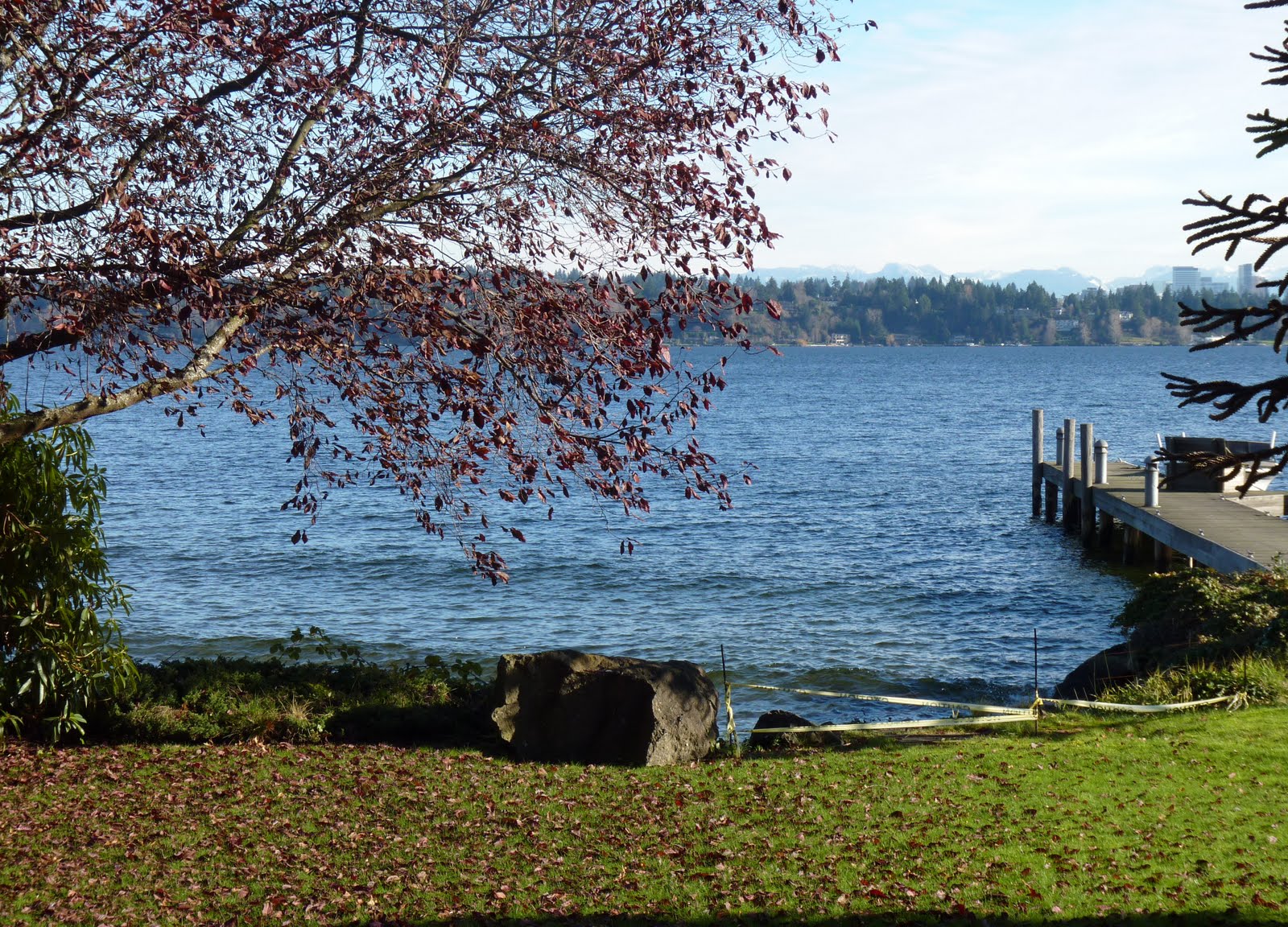
[Graphics: Upper photo shows the view from the southern portion of the roadend. Aerial photo, from Google Earth, shows the extent of the public property on the waterside, currently enclosed by private property owners. The middle photos show the obstruction of the road end as viewed from the street side, on the south and north, respectively. The bottom photo shows the entrance to the public road end from the private property to south. The map shows the six publicly owned road ends in Madison Park.]

Saturday, November 13, 2010

A survey of Madison Park road ends: Part Two

“Hidden Beach” at E. Harrison Street

Madison Park’s southernmost road end (like our rustic northernmost road end, which we profiled earlier), is a bit off the beaten path. In spite of the fact that it’s actually not the most obscure or hard-to-find waterfront road end in the neighborhood, it’s still well deserving of its local moniker: Hidden Beach. You have to venture down “Devil’s Dip” to get to it, and unless you know what you’re looking for you might very well miss the entrance.

Officially, it’s the “street end” for E. Harrison Street, which actually peters out several blocks higher up the hill, where—at its intersection with Lake Washington Boulevard E.—it terminates its role as a transportation route. This little unconnected waterfront stub of E. Harrison is not at all obvious as either a road end or as beach access (though there is a sign). Frankly, it looks very much like a homeowner’s driveway:

But E. Harrison Street without a doubt has the nicest beach of any of Madison Park’s six waterfront road ends.

You enter Hidden Beach from 39th Avenue E. (known to locals as “Devil’s Dip”) and approach it through a woodsy trail.

The trail terminates in what is a surprisingly lovely and relatively wide sandy beach, though very much smaller and far less able to accommodate a horde of sunbathers than Madison Park Beach can.

This beach, we’re told, is popular with some locals looking for water access for their dogs. A onetime beach-side resident also reports that there are occasional nude swimmers in the early morning hours, but Hidden Beach is definitely not to be confused with the famous Nudie Beach further south on the Lake (more on that in a later posting).

Hidden Beach, unlike a couple of the other waterfront road ends in Madison Park, is a well maintained and appreciated neighborhood amenity for those few who venture to take advantage.

[Upper photo: looking North from Hidden Beach (aka Secret Beach). Bottom photo: looking South. Aerial photo from Google Earth.]

Friday, September 24, 2010

A survey of Madison Park road ends: Part One

The 37th Avenue East “Beaver Lodge Sanctuary”

There are 149 streets in the City of Seattle that end at the water’s edge. These road ends are usually the unintended consequence of early City mapping, but they often provide a public right-of-way to shorelines where only private access would otherwise exist. This is not the case in Madison Park, of course, where our long and popular Madison Park Beach gives us immediate, large-scale access to Lake Washington. Nevertheless, Madison Park also has six of the City’s shoreline street ends, a few of which have been turned into lovely community jewels. While some of the road ends are fairly well known—at least to Madison Parkers who live in the immediate vicinity—others are more obscure.

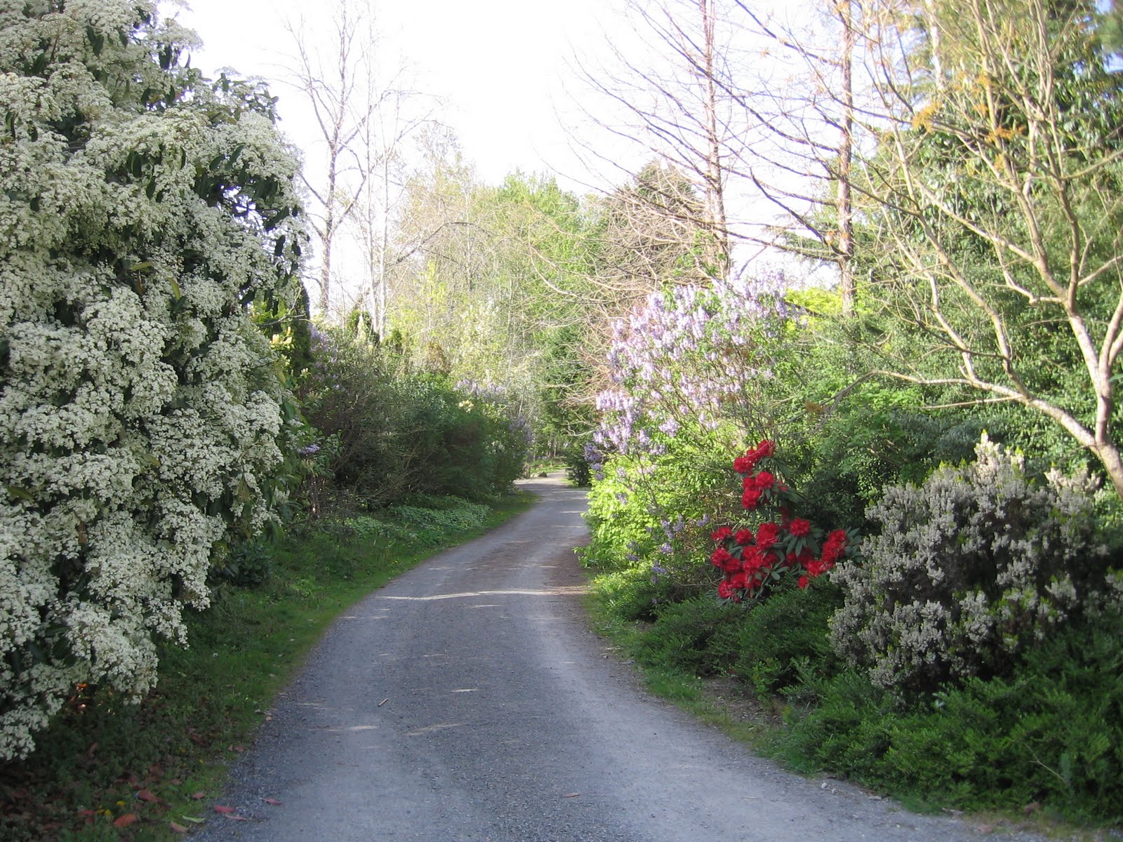
This is the first of a series which will explore each of these waterside amenities, starting today with our northernmost waterfront road end, the one at 37th Avenue E. This particular public access point, which is certainly the most wild and secluded in Madison Park, is also the most ironically placed. It’s ironic in that the street for which it is supposed to be the road end actually peters out many blocks to the south (at E. Garfield Street) and doesn’t even extend into the Canterbury neighborhood. But 37th Avenue E. suddenly and mysteriously reappears on Broadmoor’s border with Canterbury and runs for one block from E. McGilvra Street to the waters of Union Bay. Cars can and do enter this road end, since several houses along the right of way have driveways that exit onto it. But about halfway down, the road end is closed to car traffic and a gravel pedestrian path winds down to the waterside, ending at a pier on the Lake.

This road end became famous recently for the controversy over Broadmoor’s dredging operation in the area, the purpose of which was to improve the golf course’s ability to pump water from the Lake. Nature lovers were concerned about the possible negative impact of the dredging on area beavers, which fortunately returned once the dredging was finished. There is a beaver lodge directly across from the road end pier. Hense the "Beaver Lodge Sanctuary" moniker.

This road end has been the beneficiary over the last couple of years of the concerted efforts of many volunteers, who have removed the brambles and refuse and replaced them with trees and shrubs. A lovely community park has now been created where an overgrown mass of vegetation and garbage once blocked full access and obscured the view. The beautification effort has been headed up by Canterbury residents Gene and Liz Brandzel, who along with neighbors Lisa and Michael Anderson, carted eight truckloads of cuttings away from the site in their first season of cleanup. According to Gene Brandzel, the road end had previously been a general dumping ground, as well as a conveniently hidden party location for area teens. He says that he and his wife found at least 200 beer, liquor and water bottles on site when they first began their cleanup efforts. This was in addition to "innumerable used condoms, some a very patriotic red, white and blue."

Volunteers, including Ken Myrabo, Elinor Kriegsman, Trent Jackson, Paul Fredrickson, and Issac Molitch, joined forces with the Brandzels and Andersons to remove weeds and blackberry bushes and add native plantings to the road end, many of which were donated to the cause by Molitch and his wife, Lisa Taylor. Sixteen families each sponsored a tree to be planted along the pathway.

Brandzel also acknowledges the help the volunteers received from arborist Joshua Erickson of the City’s Department of Transportation, “who has been fabulous in guiding us as to what to plant and in arranging to remove dead trees and opening the site to light.” Additionally, the City provided funds for benches to be installed at two locations on the site.

Periodic work parties are necessary to maintain and nurture the road end, which has become something of a wildlife observation point and conservancy within the precincts of our urban setting. There are few places in the City where you can get in touch with nature by enjoying the sight of beavers frolicking and herrons wading, but this is one of them.

You have an opportunity to support the worthy effort of maintaining and improving this particular Madison Park amenity. A work crew of dedicated volunteers will be formed on Saturday morning to remove blackberry and knotwood shoots from the site. A second crew will be organized to spread gravel on the 350-foot path to the water. Those interested in helping out should contact Gene Brandzel at genebb@gmail.com or (206) 940-4489.


[Aside: Some may think that we actually have seven waterfront street ends in Madison Park. However, it only appears that way. As those who have been following the LOLA Project controversy know, E. Madison St. does not end at the water. It actually ends at its intersection with 43rd Avenue E. The fact that it looks like it extends to the water is an illusion, since the concrete roadway is actually the property of the City parks department and not the Seattle Department of Transportation.]

Tuesday, June 15, 2010

The road end: is it a done deal?

Several readers took exception to my posting earlier this month (“A parking lot no more”) in which I claimed that the question of park versus parking lot at the Madison Street road end had been resolved. Some observers who attended the community meetings on the subject believed the story was exaggerated or just plain wrong. Based on what they had heard, they felt it was not at all evident that parking will be eliminated in the area beyond the intersection of Madison and 43rd.

So I decided to investigate the situation further. I put a call in to Donald Harris, Seattle Parks Department’s Property and Acquisition Services Manager. I had quoted him as telling the Madison Park Community Council and the attendees at the community forum that the City intended to remove parking from the area that’s being considered for the new LOLA (Love Our Lake Access) park. Did I quote him correctly? “Yes,” he told me. But does the City’s Department of Parks & Recreation have the legal authority to take this action? “Yes,” again.

At least one park opponent doesn’t buy that. Mark Long, owner of The Attic, says that “Donald Harris does not have the final say.” He argues that the Seattle Municipal Code would prevent the Parks Department from taking action without jumping through legal hoops. And Long claims that he has an attorney’s opinion to back him up. So I asked Harris about this. “Despite what his attorney may think,” said Harris, “I don’t think that there is anything in the Code that requires us to retain this piece of Park property as parking.”

So is that the end of the story? Not quite. While it is clearly the City’s official goal to eliminate parking at the road end, it certainly won’t be happening any time soon. As Harris admits, there no money currently allocated to develop the road end into a park. “It would be stupid if we didn’t replace what’s there now with something else,” he told me. Just chaining off the road end will not accomplish anything worthwhile, he added.

And then there’s the additional complication posed by the controversy between park proponents and those who favor the status quo. “I think the City has to be responsive to a variety of needs,” he said. It is clear, he told me, that a lot more work needs to be done on the parking issue in Madison Park, and he is glad to see the business owners now engaged in the process. “We’ll need to work together to get this right,” he said.

As noted in my last posting on the subject, the LOLA committee has been looking at ways to mitigate the loss of parking spaces at the road end if LOLA is approved (that’s 17-30 spaces, depending on which side you’re talking to). And according to Community Council President Ken Myrabo, a special committee will be established to make recommendations on ways to improve the parking situation throughout the business district. The Madison Park Business Association is expected to be involved. Getting some kind of plan in place on the parking issue may now be a precursor to having the City approve funds to build the park, but that's not clear.

Meanwhile, planning for LOLA is moving forward, according to Myrabo, with the understanding that parking at the road end will not be part of the design. And Harris confirmed to me his earlier statement to the Council on the subject: “There will be absolutely no parking on this site. That was the starting point for the development of the park project.”

Sounds pretty conclusive, but stay tuned.

[Satellite photo of Madison Park business district and Madison Park from Google Earth]

Tuesday, June 1, 2010

A parking lot no more

It’s all but official. The Madison Street road end is going to end its long life as a picturesque spot for parked cars and garbage receptacles. At most, it will become a park. And at least, it will not be parked on any more.

That’s the word from the City’s Department of Parks and Recreation, as conveyed by Donald Harris, the Department’s Property and Acquisition Services Manager. He delivered the news at the Madison Park Community Council meeting earlier this month, and I understand that he repeated the news last week at the community forum at which the “final schematic design” for the LOLA project was unveiled.

Harris’s message was this: “We don’t think that Park property being parked on is good public usage. Regardless of the outcome of the [LOLA design process], we are going to reclaim the parkland.” He said that the State’s Department of Natural Resources (DNR), which owns the area of the road closest to the water, is in total agreement with the City and will also reclaim its property for use as parkland. That means that the cars and waste receptacles will have to go. The only question is when.

Technically the area in question is not a road end, though it sure looks like one. Although E. Madison Street appears to end at the barrier in front of the pier, the street actually ends at 43rd Avenue E. The area beyond 43rd is not a City street. The Parks Department therefore has the authority to cordon off the area, making it car free.

As previously reported, area merchants are none too happy about the situation, and several of them made their opposition known at the community forum last week. The purpose of the meeting was to get public input on the design for the planned park on the site, but the focus of the meeting turned instead into a discussion of parking. In the end, however, it was made clear that if there is to be any additional parking created in the neighborhood, it will not be on the site of the new LOLA park.

About fifty people showed up at the community forum for an opportunity to see and comment on the new park plan, designed by Murase Associates. The meeting was the last step in the schematic design phase for the park. The next phase is design development, according to Murase’s Liz Wreford Taylor.

The design, shown above, has been significantly scaled back from the original three design options presented by Murase at an earlier community meeting. Taylor says that final design incorporates the best elements of the initial designs and reflects the input given at the previous community meetings. The site plan features a sloping “hardscape” surface, a flat terrace area, a ramp to the pier, and no decking.

The water feature, which was a prominent element in the previous designs, is also out. Additionally, the current plan eliminates the cherry trees. They, like the wooden decking and water feature, presented a potential maintenance problem for the City, according to Taylor. It’s possible, however, that one or more of these elements might be reintroduced as the design development phase of the park moves forward. “I think the community wants cherry trees,” Taylor notes, for example. “We just need to find a way to fit them in.”

This design is by no means final, in other words. Changes in the configuration of the spaces and the materials may still occur. Taylor notes that the design team is still open to suggestions from the community. Those interested in giving their input may do so by emailing Taylor (ltaylor@murase.com), or by contacting the Madison Park Community Council (council@madisonparkcouncil.org).


[Graphics courtesy of Murase Associates. Click on images to enlarge.]

Sunday, May 16, 2010

Madison Park merchants say “NO!” to LOLA

The plan to develop a park at the end of Madison Street has suddenly become controversial, with one part of the Madison Park Establishment squaring off against another. In one corner is the Madison Park Community Council (MPCC), which is busily promoting public involvement in support of its LOLA (Love our Lake Access) project; and in the other corner are the merchants of Madison Park—including those of the Madison Park Business Association (MPBA)—who are busily signing petitions and sending emails in opposition to the Council’s grand scheme. This division appears to be a rare fracture of the “powers that be” in Madison Park. As recently as last year, the two organizations (MPCC and the MPBA) found themselves so much in alignment that they agreed to merge their websites into one (http://madisonparkseattle.com/). Now their unanimity, assuming it was ever real, has been torn asunder over an unlikely issue: parking.

What supporters of LOLA describe as a potential community “jewel” and scenic focal point at the very heart of Madison Park, the merchants see as potential threat to their livelihood. For the fact is that the area at the end of Madison Street currently serves principally as a parking lot, and the creation of a park in that space will lower the amount of close-in business district parking.

Mark Long, owner of The Attic and a leading opponent of LOLA, estimates that 25 or more parking spaces will be lost at the road end if a park is constructed at that location. And it’s parking that will not—and really cannot—be replaced anywhere in proximity to the businesses along Madison Street. Eliminating the existing parking will force people to park further away from the businesses they patronize, he says, and will result in some people deciding to forgo making the trip to Madison Park.

“Everyone that lives in the Park enjoys the benefit of a varied retail area with wide sidewalks,” he says. “However, not all realize the costs and time needed to keep the doors open. Parking is a paramount problem.” This is a position that many other area merchants support. Stan Moshier, co-owner of Bing’s, summed up the concern this way in an email to other business owners: “Parking is most necessary to our existence as a viable business, proven by the countless times we have heard ‘it takes forever to find a place to park around here’ from our patrons, both young and old.”

A similar refrain comes from Madison Park Bakery owners Karen and Terry Hofman, who emailed “In our 17 years of operation, not a week has gone by without someone mentioning or complaining about parking difficulties. On occasion, [we’ve] had to telephone some elderly customers who pre-ordered baked goods but didn’t pick up their order. The response has too often been ‘Sorry, drove down but couldn’t find anywhere to park.’”

While Long is adamant that the whole LOLA idea be dropped, other business owners, including the Hofmans, are a bit more circumspect: “We only ask that the issue of parking be seriously addressed before rapidly proceeding only on the wishes of individuals representing LOLA.”

LOLA committee members say they are attempting to address the parking concerns of the merchants. “We can collaborate with the MPBA,” says LOLA’s Kathleen Stearns, “but we are not the decision makers. The Department of Parks and Recreation is.” She notes that the land belongs to the parks department and simply is not designated for use as a parking lot. “Madison Street ends at 43rd Avenue E.,” she notes, and the area beyond 43rd down to the pier is not controlled by the City’s transportation department. Effectively, vehicle drivers who park in the area are encroaching on City parkland, since it is technically not a city street.
.
Ownership of the property is shown on this graphic (click to enlarge):
.

For LOLA supporters, the issue therefore appears to be pretty straightforward. The land is park land and should be restored to park use. This is not to say, however, that LOLA is opposed to discussing the issue with concerned business owners or working with them to find creative solutions. Stearns notes that focus groups were held (including one where the parking issue was specifically on the agenda) and the business owners also were invited to meet with the MPCC by its president Ken Myrabo. But in spite of this outreach the business owners opposing the project did not come forward, she says; and as a result, some LOLA committee members sought out various Madison Park business owners to solicit their input.

Among the ideas being floated to improve parking in the business district are these, she says:

1) Encourage more employees of these businesses to use public transportation to get to work.
2) Ask employees (as well as business owners) to park further from their places of business.
3) Limit street parking to 2 hours (versus the 1, 2 and 4-hour designations that currently exist in different parts of the business district) and have it enforced to optimize usage.
4) Ask residents to volunteer spaces in their driveways or in front of their houses for the daytime use of employees (Kathleen Stearns reports she has agreed to do this on her property).
5) Make better use of existing alley parking spaces for employees and owners.

Stearns says she believes that collaboration will solve the parking problem, and she’s dismissive of the merchants who are not interested in working with LOLA on the issue. “Their vision is a parking lot. Our competing vision is for it to be restored to public use as a garden park. These are the competing interests for this public space.” To which she adds, “We are not opposed to bringing commerce to the Park.”

"Not impressed,” says Mark Long. “There are already three parks along 43rd. Parking is the Number One need here, not more parks. I know [the current situation] is not perfect and beautiful, but it’s functional. I think LOLA is a waste of time and effort just to get one to two percent more green space.” Among the other merchants supporting this anti-LOLA position, says Long, are the owners of McGilvra’s, Tina’s on Madison, Madison Park Jewelers, Cookin’, and Martha Harris.

Cactus! owner Bret Chatalas, meanwhile, sent an email to City Council members and the parks department last month in which he expressed his support for parks but added that “I can’t imagine anyone, while thinking it through, would think that more parks in Madison Park is a better idea than providing parking for those already coming to the local three parks and beach, let alone the local businesses that rely on customers’ ability to easily access them. The ratio of parks to parking is way out of balance down here already, in my opinion.”

Unfortunately, there is no real room for compromise here. Succinctly, the question is this: park or parking lot? The area at the end of Madison Street can’t be both.

So which is it to be?

Given both the controversy and the uncertainty of funding, it's probably going to be quite awhile before we find out which faction of the Madison Park Establishment will ultimately have its way.
.
[Everyone, Madison Park business owners included, will get another opportunity to give their input when, on May 26, the final schematic design for LOLA will be presented at a community meeting to be held at Park Shore Retirement Community (1630 43rd Avenue E.) at 7:00 pm.]

Wednesday, May 12, 2010

Dredging ends, beavers return

I haven’t seen the furry critters myself, but I have it upon reliable eye-witness authority that the beavers are now back frolicking in the waters off the northern coast of Madison Park. This, in spite of the two weeks of dredging in the area recently undertaken by Broadmoor’s contractor. The dredging company pulled out last week, meaning (I guess) that water from the Lake is now free to gush unhindered into the irrigation pipes of the golf course.
.
I don’t get up early enough, unfortunately, to get a shot of swimming beavers (who, I am told, are most likely to be seen after sunrise); but Canterbury resident Gene Brandzel provided this fuzzy shot last week to prove his point either that the Loch Ness monster lives or that the beavers are really back in Canterbury (Gene admits that the lighting was bad). He reports that there were four adult beavers on show at 5:30 that particular morning, which just happened to be a couple of days before the dredging equipment was evacuated. “Some of the beavers slapped their tails right next to the dredge to say goodbye,” Brandzel said. “It was quite touching.”

Broadmoor isn’t the only community, by the way, to benefit from the dredging effort. As a condition of one of the permits that Broadmoor needed to obtain for the project, the Washington State Department of Fish & Wildlife required that the pier at the end of 37th Avenue E., near the dredging site, be resurfaced. The old surface of the pier (aka “dock”) was wooden, allowing little light to penetrate into waters underneath. The new pier has slots that allow the light to shine through. This, in theory, should be good for the aquatic and plant life of the bay.

It's nice to know that the fears of many of us that the beavers might be disturbed as a result of the dredging have apparently proved overblown. The waters look serene, the beaver lodge remains intact, and we presumably can soon look forward to seeing the results of another successful breading season. If anyone gets a good shot of the new brood, please share with us!


[Middle photo: the wooden housing for the Broadmoor irrigation system intake pipe, around which the dredging occurred.]

Tuesday, May 4, 2010

Why a park?

KING-TV last week used the proposed park for the E. Madison Street road end (the LOLA project) as a jumping off point for a story asking why the City is going ahead with plans for new parks when it can’t even afford the upkeep on some of the ones it currently operates. It’s pretty well known that plans are afoot to reduce staffing this year in Seattle’s Parks & Recreation Department due to budget constraints. This means fewer people working maintenance and operations in the parks. Noting, in addition, that the Department is considering closing certain swimming pools, community centers, and wading pools, correspondent Linda Brill interviewed three Madison Park residents (Reg Newbeck, Jane Carter, and Ginny Thomas) who each sounded* as if they agreed that it doesn’t make sense to build a new park if the City can’t pay for proper maintenance of the existing ones.

Brill, however, may have been a bit off base in using the Madison Street park project as a cause célèbre for her story about the City’s dilemma in having a $15 million from a 2008 parks bond issue that it must spend on new parks but can’t legally use for park operations. First of all, the Madison Street park project is not moving forward, as Brill implied, simply because there is a bunch of money that’s sitting in a kitty awaiting park projects to fund. The LOLA project has been developed organically within the neighborhood and is being spearheaded by the Madison Park Community Council. The Council does plan to apply for grants from the City, including money from the bond issue, but efforts to create a park at the road end predate this potential funding source.

Secondly, it’s certainly not true that “the plan would be to cover over the concrete with grass” at our road end, as Brill reported. Far from it.

Three possible road end plans, in fact, were presented to a community meeting held last month at Park Shore. And none of them involved much, if any, grass. Murase Associates, at the behest of the LOLA (Love Our Lake Access) Committee, developed the multiple options after getting the input of several focus groups during the past few months. Here is an overview of the concepts, as presented:

Option One: Focus on the View

This proposed plan (click to enlarge) features active lookouts with terraces, small garden patches, concrete or stone pavers, a trellis, and decking. There is also a prominent water feature: a stormwater runnal down the middle of the space, which will empty into the Lake.

These are illustrations of some similar design elements as used in other installations, not necessarily ones designed by Murase:


Option Two: The Step-Down

This proposed plan features a sloped transition into the existing lawn at the right of the road end, so there would be some additional grass added to the site. A major element of this plan is a curving stone wall, with a stormwater runnel alongside. There is also a profusion of cherry trees, some wood benches, and stone steps leading down to an overlook area.

Here are some illustrations of design elements from this plan:
.

.
Option Three: Intimacy and Privacy

This proposed plan features a shallow stormwater reflecting pool and a cascading stormwater feature enclosed in stone blocks. There would be some additional lawn in this plan, as well as cherry trees, stone boulders, and some stepped terrace seating.

Here are some illustrations of design elements from this plan:


As presented by Murase Associates, these plans each reflect what the LOLA Committee felt were the “big ideas” arising from the various forums held to solicit input: 1) green space, 2) public access, 3) passive recreation, and 4) an opportunity to interpret history.

Because the site was for 80 or more years a ferry dock, the Committee felt that any design should incorporate a nod to the past with some kind of historic element. Additionally, the Committee concluded that any final plan should emphasize these three design concepts: gardens, views, and seating. And according to LOLA Committee member Kathleen Stearns, the road end park is also intended to be low maintenance.

The audience of 40 or 50 Madison Parkers who heard the presentation seemed enthusiastic about the designs, and plenty of input was provided about what seemed to work and not work in each of the plans. It is now up to Murase to create a final proposed site design which incorporates the best elements of the three options. This final schematic design will be unveiled at another community meeting to be held at Park Shore (1630 43rd Avenue E.) on May 26 (7:00 pm). If you have input you would like to make concerning these conceptual plans you may direct your comments to lolawatersidepark@gmail.com.

We will be following up with another blog posting next week on one of the most controversial aspects of the LOLA project: the impact on parking in the vicinity. Let’s just say that not everyone is too happy with the idea of taking out all of that concrete. More to follow…
.
[*At least one of those interviewed, Reg Newbeck, reports that his quote was taken out of context and that he actually supports the idea of a road end park.]
.
Graphics courtesy of Murase Associates

Tuesday, April 20, 2010

Broadmoor begins dredging

With all required permits in place, Broadmoor’s contractor began pulling the sludge from Union Bay yesterday around the intake pipe for the golf course’s watering system. As we’ve reported previously, Broadmoor wants green grass in the summer, and that apparently requires more water than the intake pipe could accommodate. Deepening the channel in the area surrounding the intake pipe will supposedly solve the problem for the immediate future.

Not everyone is happy about the situation, however. Canterbury resident Gene Brandzel led the effort to keep the City from approving Broadmoor’s permit request as originally submitted. His concern, and that of other wildlife enthusiasts, was that a nearby beaver lodge would be disrupted during the dredging and the beavers might be negatively impacted, perhaps even abandoning their home. In the end, the City decided that the Madison Park beavers were not in jeopardy.

Seattle’s Department of Planning & Development Director, Diane Sugimura, sent Brandzel an email today in which she stated “the beaver are not an endangered species, and their habitat is not protected.” She commented that based on discussions with the State’s Department of Fish & Wildlife, she believes the beavers will probably not leave the area, as they are used to an urban environment with a lot of noise and activity. As evidence she cited the lodge’s proximity to SR-520. In the end, she said, she was sorry that her decision to grant the permit was not what Brandzel wanted, but “I do feel that our decision meets our regulatory authority.”

This is not quite a “Beavers be Damned” story, however, since the opposition by Brandzel and others to Broadmoor’s original plans did result, as Sugimura noted in her email, in a significantly reduced area and depth of dredging. Nevertheless, as can be seen in the photo below, the boom area is pretty close to the beaver damn, which is visible directly in front the dock at the 37th Avenue E. road end.

Brandzel, meanwhile, is unhappy not only with the outcome but with the process as well. “These are not ordinary beavers” he wrote in response to Sigimura, “and treating them as if they are is closing one’s eyes to the uniqueness of having these creatures as part of an urban community.” Brandzel is calling for volunteers to monitor the dredging activity to be sure that it complies with the permit. If you’re interested in helping, you can contact him at genebb@gmail.com or (206) 940-4489.

Dredging is expected to continue for two to three weeks.